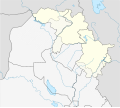
File:Iraq Kurdistan location map.svg
外观

此SVG文件的PNG预览的大小:672 × 600像素。 其他分辨率:269 × 240像素 | 538 × 480像素 | 860 × 768像素 | 1,147 × 1,024像素 | 2,294 × 2,048像素 | 1,372 × 1,225像素。
原始文件 (SVG文件,尺寸为1,372 × 1,225像素,文件大小:374 KB)
文件历史
点击某个日期/时间查看对应时刻的文件。
| 日期/时间 | 缩略图 | 大小 | 用户 | 备注 | |
|---|---|---|---|---|---|
| 当前 | 2017年10月25日 (三) 02:32 |  | 1,372 × 1,225(374 KB) | Rob984 | minor |
| 2017年10月25日 (三) 02:15 |  | 1,372 × 1,225(374 KB) | Rob984 | minor fixes | |
| 2017年10月25日 (三) 01:34 |  | 1,372 × 1,225(413 KB) | Rob984 | I've updated the official borders according to the KRG per http://www.krso.net/files/articles/071015030355.jpg I've also indicated the disputed territories within the official borders, as the federal government has not agreed to these borders or the... | |
| 2014年6月13日 (五) 01:03 |  | 1,372 × 1,225(277 KB) | Spesh531 | adding halabja | |
| 2009年5月27日 (三) 18:33 |  | 1,372 × 1,225(273 KB) | NordNordWest | {{Information |Description= {{de|Positionskarte der Autonomen Region Kurdistan, Irak}} Quadratische Plattkarte, N-S-Streckung 115 %. Geographische Begrenzung der Karte: * N: 37.7° N * S: 33.2° N * W: 40.8° |
文件用途
以下4个页面使用本文件:
全域文件用途
以下其他wiki使用此文件:
- ar.wikipedia.org上的用途
- azb.wikipedia.org上的用途
- ba.wikipedia.org上的用途
- bg.wikipedia.org上的用途
- ckb.wikipedia.org上的用途
- ڕانیە
- ھەڵەبجە
- کەرکووک
- زەڕایەن
- چەمچەماڵ
- داڕێژە:دابەشکارییە کارگێڕییەکانی ھەرێمی کوردستان
- پارێزگای سلێمانی
- پارێزگای ھەولێر
- پارێزگای دھۆک
- خانەقین
- شەقڵاوە
- کۆیە
- پێنجوێن
- دھۆک
- دەربەندیخان
- سۆران (شار)
- ڕەواندز
- مووسڵ
- ئامێدی
- زاخۆ
- قەزای سەید سادق
- کفری
- ئاکرێ
- پردێ
- ھەولێر
- سەنگاو
- داقووق
- سلێمانی
- تەقتەق
- سیدەکان
- بەردەڕەش
- کەلار
- ئیدارەی گەرمیان
- قەڵادزێ
- قەزای ھەولێر
- قەزای شەقڵاوە
- قەزای سۆران
- قەزای مێرگەسۆر
- قەزای چۆمان
- قەزای دەشتی ھەولێر
- خەبات (قەزا)
- مەخموور
- قەزای کۆیە
- قەزای ڕەواندز
- پۆل:قەزاکانی کوردستان
查看此文件的更多全域用途。

