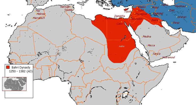
File:Bahri Dynasty 1250 - 1382 (AD).PNG
外觀

預覽大小:800 × 429 像素。 其他解析度:320 × 171 像素 | 821 × 440 像素。
原始檔案 (821 × 440 像素,檔案大小:36 KB,MIME 類型:image/png)
檔案歷史
點選日期/時間以檢視該時間的檔案版本。
| 日期/時間 | 縮圖 | 尺寸 | 使用者 | 備註 | |
|---|---|---|---|---|---|
| 目前 | 2018年2月5日 (一) 18:22 |  | 821 × 440(36 KB) | Maphobbyist | Modern borders of Turkey, because Hatay Province is part of Turkey since 1939 and borders of South Sudan which became independent in 2011. |
| 2010年7月3日 (六) 00:07 |  | 821 × 440(30 KB) | Dcoetzee | Remove watermark | |
| 2008年8月7日 (四) 18:40 |  | 821 × 440(36 KB) | File Upload Bot (Magnus Manske) | {{BotMoveToCommons|en.wikipedia}} {{Information |Description={{en|''no original description''}} |Source=Transferred from [http://en.wikipedia.org en.wikipedia]; transferred to Commons by User:Muhends using [http://tools.wikimedia.de/~magnus/commonshe |
檔案用途
下列3個頁面有用到此檔案:
全域檔案使用狀況
以下其他 wiki 使用了這個檔案:
- ast.wikipedia.org 的使用狀況
- az.wikipedia.org 的使用狀況
- ba.wikipedia.org 的使用狀況
- bg.wikipedia.org 的使用狀況
- bn.wikipedia.org 的使用狀況
- bs.wikipedia.org 的使用狀況
- ca.wikipedia.org 的使用狀況
- ckb.wikipedia.org 的使用狀況
- de.wikipedia.org 的使用狀況
- en.wikipedia.org 的使用狀況
- History of Islam
- History of Israel
- Timeline of Jerusalem
- Egypt in the Middle Ages
- Portal:Israel
- Mongol invasions of the Levant
- Wikipedia:WikiProject Arab world/Images, maps and media/Gallery
- User:Arab Hafez/Map
- Egypt–Mongolia relations
- Al-Adil Kitbugha
- Al-Sa'id Baraka
- Solamish
- Lajin
- History of Palestine
- User:Arman ad60/sandbox
- User:প্রলয়স্রোত/sandbox
- User:Evad37/Random slideshow sandbox testcases
- User:Falcaorib/Medieval Empires (1300-1500 AD)
- User:Falcaorib/Iran
- eo.wikipedia.org 的使用狀況
- es.wikipedia.org 的使用狀況
- fa.wikipedia.org 的使用狀況
- fi.wikipedia.org 的使用狀況
- fr.wikipedia.org 的使用狀況
- gl.wikipedia.org 的使用狀況
- he.wikipedia.org 的使用狀況
- hy.wikipedia.org 的使用狀況
- id.wikipedia.org 的使用狀況
- it.wikipedia.org 的使用狀況
檢視此檔案的更多全域使用狀況。


