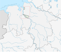
File:Bremen location map.svg
外觀

此 SVG 檔案的 PNG 預覽的大小:441 × 600 像素。 其他解析度:176 × 240 像素 | 353 × 480 像素 | 565 × 768 像素 | 753 × 1,024 像素 | 1,506 × 2,048 像素 | 492 × 669 像素。
原始檔案 (SVG 檔案,表面大小:492 × 669 像素,檔案大小:364 KB)
檔案歷史
點選日期/時間以檢視該時間的檔案版本。
| 日期/時間 | 縮圖 | 尺寸 | 使用者 | 備註 | |
|---|---|---|---|---|---|
| 目前 | 2010年1月20日 (三) 12:43 |  | 492 × 669(364 KB) | TUBS | korr wg. de:Luneplate |
| 2009年3月17日 (二) 12:24 |  | 492 × 669(232 KB) | TUBS | Weserinseln zu NI | |
| 2009年3月17日 (二) 12:09 |  | 492 × 669(232 KB) | TUBS | added Stadtbremische Brememerhaven area and its border | |
| 2009年1月26日 (一) 11:44 |  | 492 × 669(231 KB) | TUBS | {{Information |Description= |Source= |Date= |Author= |Permission= |other_versions= }} | |
| 2009年1月25日 (日) 22:59 |  | 206 × 280(222 KB) | TUBS | == Summary == {{Information |Description= {{de|Positionskarte Nordrhein-Westfalen, Germany. Geographische Begrenzung der Karte:}} {{en|Location map North Rhine-Westphalia, Germany. Geographic li | |
| 2009年1月25日 (日) 22:39 |  | 206 × 280(222 KB) | TUBS | == Summary == {{Information |Description= {{de|Positionskarte Nordrhein-Westfalen, Germany. Geographische Begrenzung der Karte:}} {{en|Location map North Rhine-Westphalia, Germany. Geographic li | |
| 2009年1月25日 (日) 22:28 |  | 1,424 × 1,203(222 KB) | TUBS | == Summary == {{Information |Description= {{de|Positionskarte Nordrhein-Westfalen, Germany. Geographische Begrenzung der Karte:}} {{en|Location map North Rhine-Westphalia, Germany. Geographic li |
檔案用途
下列3個頁面有用到此檔案:
全域檔案使用狀況
以下其他 wiki 使用了這個檔案:
- ar.wikipedia.org 的使用狀況
- ba.wikipedia.org 的使用狀況
- bg.wikipedia.org 的使用狀況
- ceb.wikipedia.org 的使用狀況
- da.wikipedia.org 的使用狀況
- de.wikipedia.org 的使用狀況
- Weserstadion
- Flughafen Bremen
- Universum Bremen
- Stadthalle Bremen
- Kraftwerk Bremen-Hafen
- Verkehrslandeplatz Bremerhaven-Luneort
- Kraftwerk Mittelsbüren
- Weserpark
- Leuchtturm Bremerhaven
- Klinikum Bremerhaven
- Benutzer:Spischot/Sketchpad 3
- Klinikum Links der Weser
- Eisstadion Bremerhaven
- Weserstadion Platz 11
- Atlantic Hotel Sail City
- Weser Tower
- Kraftwerk Bremen-Hastedt
- Roland-Center
- Nordsee-Stadion
- Wikipedia:Kartenwerkstatt/Positionskarten/Europa
- Waterfront Bremen
- Kraftwerk Farge
- Müllheizkraftwerk Bremen
- Klinikum Bremen-Nord
- Klinikum Bremen-Ost
- Torfkähne Bremen
- Vorlage:Positionskarte Deutschland Bremen
- Klinikum Bremen-Mitte
- Molenfeuer Überseehafen Süd
- Rotes Kreuz Krankenhaus Bremen
- Eisarena Bremerhaven
- AMEOS Klinikum Bremen
- Vegesacker Hafen
- Benutzer:Dr.Haus/Pier 2
- Benutzer:Spischot/Sketchpad 3/ParmPart
- Benutzer:Spischot/Sketchpad 3/code
- Stadthalle Bremerhaven
- Gemeinschaftskraftwerk Bremen
- Mittelkalorik-Kraftwerk Bremen
- Siemens-Hochhaus (Bremen)
- Fußball-Bremen-Liga 2012/13
- Leuchtturm Kaiserschleuse
- St. Joseph-Stift (Bremen)
- Benutzer:Dr.Haus /Werkstatt/Bahnhof Bremen-Sebaldsbrück
- Fußball-Bremen-Liga 2013/14
檢視此檔案的更多全域使用狀況。


