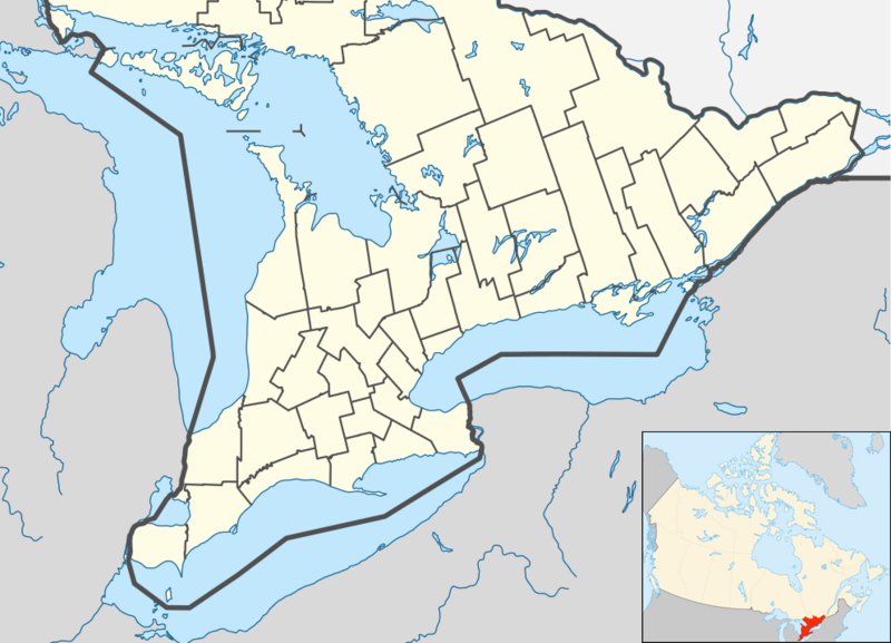
File:Canada Southern Ontario location map 2.png
外觀

預覽大小:800 × 577 像素。 其他解析度:320 × 231 像素 | 640 × 462 像素 | 994 × 717 像素。
原始檔案 (994 × 717 像素,檔案大小:296 KB,MIME 類型:image/png)
檔案歷史
點選日期/時間以檢視該時間的檔案版本。
| 日期/時間 | 縮圖 | 尺寸 | 使用者 | 備註 | |
|---|---|---|---|---|---|
| 目前 | 2012年7月20日 (五) 05:47 |  | 994 × 717(296 KB) | 117Avenue | slight fix |
| 2012年7月20日 (五) 05:43 |  | 994 × 717(296 KB) | 117Avenue | {{Information |Description ={{en|1=Location map of Southern Ontario, Canada. Equirectangular projection, N/S stretching 155%. Geographic limits of the map: * N: 46.4° N * S: 41.4° N * W: 84.7° W * E: 74.0°... |
檔案用途
全域檔案使用狀況
以下其他 wiki 使用了這個檔案:
- ar.wikipedia.org 的使用狀況
- azb.wikipedia.org 的使用狀況
- ban.wikipedia.org 的使用狀況
- bn.wikipedia.org 的使用狀況
- bs.wikipedia.org 的使用狀況
- ceb.wikipedia.org 的使用狀況
- ckb.wikipedia.org 的使用狀況
- cs.wikipedia.org 的使用狀況
- en.wikipedia.org 的使用狀況
- Bay of Quinte
- Hamilton, Ontario
- Ottawa
- Windsor, Ontario
- Niagara Falls
- Waterloo, Ontario
- Sarnia
- Perth, Ontario
- Kitchener, Ontario
- Point Pelee National Park
- Kingston, Ontario
- Brampton
- Caledon, Ontario
- Prescott, Ontario
- Leamington, Ontario
- Cornwall, Ontario
- Guelph
- Aurora, Ontario
- Barrie
- Belleville, Ontario
- Brantford
- Brockville
- Burlington, Ontario
- Cambridge, Ontario
- Lindsay, Ontario
- Markham, Ontario
檢視此檔案的更多全域使用狀況。


