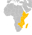
File:Eastern-Africa-map.PNG
外觀
Eastern-Africa-map.PNG (360 × 392 像素,檔案大小:10 KB,MIME 類型:image/png)
檔案歷史
點選日期/時間以檢視該時間的檔案版本。
| 日期/時間 | 縮圖 | 尺寸 | 使用者 | 備註 | |
|---|---|---|---|---|---|
| 目前 | 2018年3月17日 (六) 18:41 |  | 360 × 392(10 KB) | Maphobbyist | Montenegro border |
| 2012年12月21日 (五) 03:49 |  | 360 × 392(8 KB) | Spacepotato | Recolor South Sudan, since in the current version of the UN geographic classification scheme, http://unstats.un.org/unsd/methods/m49/m49regin.htm , South Sudan has been placed in Eastern Africa. | |
| 2011年7月9日 (六) 20:58 |  | 360 × 392(13 KB) | Maphobbyist | South Sudan has become independent on July 9, 2011. Sudan and South Sudan are shown with the new international border between them. | |
| 2007年12月7日 (五) 13:30 |  | 360 × 392(14 KB) | Vervictorio | {{Information |Description=The map of Africa |Source=Own work |Date=2007.12.07. |Author=Vervictorio |Permission=See below. |other_versions= }} Category:Maps of Africa |
檔案用途
下列頁面有用到此檔案:
全域檔案使用狀況
以下其他 wiki 使用了這個檔案:
- ab.wikipedia.org 的使用狀況
- am.wikipedia.org 的使用狀況
- ar.wikipedia.org 的使用狀況
- de.wikipedia.org 的使用狀況
- de.wikivoyage.org 的使用狀況
- diq.wikipedia.org 的使用狀況
- el.wikipedia.org 的使用狀況
- en.wikipedia.org 的使用狀況
- et.wikipedia.org 的使用狀況
- fa.wikipedia.org 的使用狀況
- fi.wikipedia.org 的使用狀況
- hu.wikipedia.org 的使用狀況
- Algéria címere
- Angola címere
- Kenya címere
- Benin címere
- Bissau-Guinea címere
- Botswana címere
- Burkina Faso címere
- Burundi címere
- Comore-szigetek címere
- Csád címere
- A Dél-afrikai Köztársaság címere
- Szent Ilona címere
- Dzsibuti címere
- Egyenlítői-Guinea címere
- Egyiptom címere
- Elefántcsontpart címere
- Eritrea címere
- Etiópia címere
- Gabon címere
- Gambia címere
- Ghána címere
- Guinea címere
- Kamerun címere
- A Kongói Köztársaság címere
- A Közép-afrikai Köztársaság címere
- Lesotho címere
- Libéria címere
- Líbia címere
- Sablon:Afrika címerei
- Madagaszkár címere
- Malawi címere
- Mali címere
- Marokkó címere
- Mauritánia címere
檢視此檔案的更多全域使用狀況。


