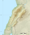
File:Lebanon location map Topographic.png
外觀

預覽大小:521 × 599 像素。 其他解析度:209 × 240 像素 | 417 × 480 像素 | 993 × 1,142 像素。
原始檔案 (993 × 1,142 像素,檔案大小:990 KB,MIME 類型:image/png)
檔案歷史
點選日期/時間以檢視該時間的檔案版本。
| 日期/時間 | 縮圖 | 尺寸 | 使用者 | 備註 | |
|---|---|---|---|---|---|
| 目前 | 2017年6月22日 (四) 06:17 |  | 993 × 1,142(990 KB) | Vivepat | correction lat/lon |
| 2017年6月22日 (四) 06:10 |  | 993 × 1,142(990 KB) | Vivepat | Lattitude error correction | |
| 2017年6月22日 (四) 05:59 |  | 993 × 1,142(990 KB) | Vivepat | update of the map using the Wikipedia maps conventions | |
| 2012年6月15日 (五) 22:12 |  | 1,581 × 1,818(3.35 MB) | Dr Brains |
檔案用途
下列6個頁面有用到此檔案:
全域檔案使用狀況
以下其他 wiki 使用了這個檔案:
- als.wikipedia.org 的使用狀況
- an.wikipedia.org 的使用狀況
- ar.wikipedia.org 的使用狀況
- arz.wikipedia.org 的使用狀況
- ast.wikipedia.org 的使用狀況
- az.wikipedia.org 的使用狀況
- bn.wikipedia.org 的使用狀況
- bs.wikipedia.org 的使用狀況
- ca.wikipedia.org 的使用狀況
- ceb.wikipedia.org 的使用狀況
- ce.wikipedia.org 的使用狀況
- cs.wikipedia.org 的使用狀況
- da.wikipedia.org 的使用狀況
- el.wikipedia.org 的使用狀況
- en.wikipedia.org 的使用狀況
檢視此檔案的更多全域使用狀況。


