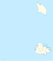
File:Antigua and Barbuda (no subdivisions) location map.svg
外觀

此 SVG 檔案的 PNG 預覽的大小:556 × 600 像素。 其他解析度:222 × 240 像素 | 445 × 480 像素 | 712 × 768 像素 | 949 × 1,024 像素 | 1,898 × 2,048 像素 | 1,152 × 1,243 像素。
原始檔案 (SVG 檔案,表面大小:1,152 × 1,243 像素,檔案大小:81 KB)
檔案歷史
點選日期/時間以檢視該時間的檔案版本。
| 日期/時間 | 縮圖 | 尺寸 | 用戶 | 備註 | |
|---|---|---|---|---|---|
| 目前 | 2022年8月11日 (四) 23:55 |  | 1,152 × 1,243(81 KB) | Smasongarrison | cleaner paths with svgomg // Editing SVG source code using c:User:Rillke/SVGedit.js |
| 2013年10月21日 (一) 17:29 |  | 1,080 × 1,243(182 KB) | TUBS | {{Information |Description={{de|1=Positionskarte von {{w|Antigua und Barbuda|3=de}}. Geographische Begrenzungen der Karte: * N: 17.755° N * S: 16.919° N * W: 62.4° W * E: 61.639° W}} {{en|1=Location map of {{w|Antigua and Barbuda}}. Geographic lim... |
檔案用途
下列頁面有用到此檔案:
全域檔案使用狀況
以下其他 wiki 使用了這個檔案:
- ami.wikipedia.org 的使用狀況
- de.wikipedia.org 的使用狀況
- nn.wikipedia.org 的使用狀況
- no.wikipedia.org 的使用狀況


