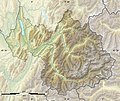
File:Savoie department relief location map.jpg
外觀

預覽大小:714 × 600 像素。 其他解析度:286 × 240 像素 | 572 × 480 像素 | 915 × 768 像素 | 1,104 × 927 像素。
原始檔案 (1,104 × 927 像素,檔案大小:372 KB,MIME 類型:image/jpeg)
檔案歷史
點選日期/時間以檢視該時間的檔案版本。
| 日期/時間 | 縮圖 | 尺寸 | 用戶 | 備註 | |
|---|---|---|---|---|---|
| 目前 | 2010年7月17日 (六) 22:24 |  | 1,104 × 927(372 KB) | Sting | Color profile |
| 2008年8月5日 (二) 00:32 |  | 1,104 × 927(425 KB) | Sting | More precise boundaries | |
| 2008年7月30日 (三) 18:49 |  | 1,104 × 927(422 KB) | Sting | - border ; + rivers ; int. boundary passing on top of Mont Blanc | |
| 2008年7月19日 (六) 23:35 |  | 1,104 × 927(400 KB) | Sting | {{Location|45|30|00|N|06|24|00|E|scale:1000000}} <br/> {{Information |Description={{en|Blank relief map of the department of Savoie, France, for geo-location purpose.<br/>Scale : 1:800,000 (precision : 200 m)}} {{fr|Carte vierge du relief d |
檔案用途
下列頁面有用到此檔案:
全域檔案使用狀況
以下其他 wiki 使用了這個檔案:
- als.wikipedia.org 的使用狀況
- bs.wikipedia.org 的使用狀況
- cs.wikipedia.org 的使用狀況
- da.wikipedia.org 的使用狀況
- de.wikipedia.org 的使用狀況
- Col de l’Iseran
- Fréjus-Straßentunnel
- Col du Mont Cenis
- Col du Télégraphe
- Lac du Bourget
- Cormet de Roselend
- Col de Méraillet
- Roselend-Talsperre
- Col de Clapier
- Col de la Croix de Fer
- Col de la Madeleine
- Col du Glandon
- Mont Thabor
- Mont Pourri
- Dent Parrachée
- Grande Motte
- Wikipedia:Kartenwerkstatt/Positionskarten/Europa
- Vorlage:Positionskarte Frankreich Savoie
- Refuge du Col de la Croix du Bonhomme
- Mont Cenis
- Lac du Mont Cenis
- Girotte-Talsperre
- Lac d’Aiguebelette
- Pic du Thabor
- Pic de Bonvoisin
- Refuge du Carro
- Refuge d’Avérole
- Refuge des Évettes
- Mont-Cenis-Eisenbahntunnel
- Signal du Grand Mont Cenis
- Pointe de Ronce
- Benutzer:Wompratte/Col de Péguère
檢視此檔案的更多全域使用狀況。


