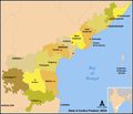
File:Map AP dist all shaded.png
外觀

預覽大小:702 × 599 像素。 其他解析度:281 × 240 像素 | 562 × 480 像素 | 922 × 787 像素。
原始檔案 (922 × 787 像素,檔案大小:110 KB,MIME 類型:image/png)
檔案歷史
點選日期/時間以檢視該時間的檔案版本。
| 日期/時間 | 縮圖 | 尺寸 | 用戶 | 備註 | |
|---|---|---|---|---|---|
| 目前 | 2021年3月8日 (一) 07:57 |  | 922 × 787(110 KB) | Sbb1413 | Added the names of unnamed district HQs, plus the surrounding states. Removed the locator map as it (incorrectly) shows Aksai Chin as under the administration of India. |
| 2021年3月5日 (五) 07:15 |  | 923 × 790(105 KB) | Sbb1413 | Removed Hyderabad as capital, added Amaravati, Kurnool and Visakhapatnam as capitals. | |
| 2014年6月2日 (一) 11:20 |  | 923 × 881(83 KB) | Adityamadhav83 | map updated after bifurcation of Andhra Pradesh | |
| 2006年1月7日 (六) 12:19 |  | 923 × 881(63 KB) | Miljoshi | Map of w:Andhra Pradesh, India with district boundaries - add districts shaded. Category:Andhra Pradesh district maps |
檔案用途
全域檔案使用狀況
以下其他 wiki 使用了這個檔案:
- ast.wikipedia.org 的使用狀況
- awa.wikipedia.org 的使用狀況
- bn.wikipedia.org 的使用狀況
- ca.wikipedia.org 的使用狀況
- es.wikipedia.org 的使用狀況
- fi.wikipedia.org 的使用狀況
- frr.wikipedia.org 的使用狀況
- fr.wikipedia.org 的使用狀況
- gu.wikipedia.org 的使用狀況
- hi.wikipedia.org 的使用狀況
- hu.wikipedia.org 的使用狀況
- id.wikipedia.org 的使用狀況
- it.wikipedia.org 的使用狀況
- ja.wikipedia.org 的使用狀況
- kn.wikipedia.org 的使用狀況
- ml.wikipedia.org 的使用狀況
- nl.wikipedia.org 的使用狀況
檢視此檔案的更多全域使用狀況。


