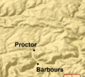
File:Plunketts Creek Relief Map.PNG
外觀

預覽大小:664 × 600 像素。 其他解析度:266 × 240 像素 | 532 × 480 像素 | 886 × 800 像素。
原始檔案 (886 × 800 像素,檔案大小:107 KB,MIME 類型:image/png)
檔案歷史
點選日期/時間以檢視該時間的檔案版本。
| 日期/時間 | 縮圖 | 尺寸 | 用戶 | 備註 | |
|---|---|---|---|---|---|
| 目前 | 2013年4月5日 (五) 00:07 |  | 886 × 800(107 KB) | Ruhrfisch | Add labels for Barbours and Proctor, all other info the same |
| 2013年4月5日 (五) 00:02 |  | 886 × 800(107 KB) | Ruhrfisch | Add labels for Barbours and Proctor, all other info the same | |
| 2013年4月5日 (五) 00:01 |  | 886 × 800(107 KB) | Ruhrfisch | Add labels for Barbours and Proctor, all other info the same | |
| 2008年7月15日 (二) 05:07 |  | 885 × 800(134 KB) | Jarekt | {{Information |Description=Cropped watermark |Source= |Date= |Author= |Permission= |other_versions= }} | |
| 2007年8月13日 (一) 02:31 |  | 905 × 800(141 KB) | Ruhrfisch | {{Information| |Description= Relief Map of Plunketts Creek Watershed in Lycoming and Sullivan Counties, Pennsylvania, United States |Source= This is a section of a map taken from the planiglobe website [http://www.planiglobe.com/omc_set.html] and enlarge |
檔案用途
全域檔案使用狀況
以下其他 wiki 使用了這個檔案:
- en.wikipedia.org 的使用狀況
- ha.wikipedia.org 的使用狀況
- te.wikipedia.org 的使用狀況


