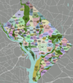
File:DC neighborhoods map.png
外观

本预览的尺寸:526 × 599像素。 其他分辨率:211 × 240像素 | 421 × 480像素 | 674 × 768像素 | 899 × 1,024像素 | 1,493 × 1,700像素。
原始文件 (1,493 × 1,700像素,文件大小:1.52 MB,MIME类型:image/png)
文件历史
点击某个日期/时间查看对应时刻的文件。
| 日期/时间 | 缩略图 | 大小 | 用户 | 备注 | |
|---|---|---|---|---|---|
| 当前 | 2011年9月2日 (五) 02:21 |  | 1,493 × 1,700(1.52 MB) | Peterfitzgerald | minor change |
| 2011年9月2日 (五) 02:15 |  | 1,493 × 1,700(1.52 MB) | Peterfitzgerald | Lots of corrections and refinements | |
| 2010年1月4日 (一) 20:53 |  | 1,493 × 1,700(1.5 MB) | Peterfitzgerald | split off Kalorama Triangle from Adams Morgan, adjusted Fairlawn & Randall Heights boundaries, & split off Spring Valley from American University Park | |
| 2009年1月30日 (五) 21:45 |  | 1,493 × 1,700(1.53 MB) | Peterfitzgerald | too high res, it would seem | |
| 2009年1月30日 (五) 21:39 |  | 4,390 × 5,000(5.66 MB) | Peterfitzgerald | increase resolution | |
| 2008年9月4日 (四) 14:32 |  | 1,493 × 1,700(1.53 MB) | Peterfitzgerald | increase font size for better in-article readability | |
| 2008年4月21日 (一) 02:33 |  | 1,493 × 1,700(1.43 MB) | Peterfitzgerald | a few fixes | |
| 2008年4月14日 (一) 17:10 |  | 1,493 × 1,700(1.46 MB) | Peterfitzgerald | Separate Burleith from Georgetown | |
| 2008年2月23日 (六) 02:37 |  | 1,493 × 1,700(1.41 MB) | Peterfitzgerald | {{Information |Description=DC neighborhoods map |Source=self-made, tracing done from PD satellite imagery |Date=22 February 2008 |Author= Peter Fitzgerald |Permission=CC-by-SA 3.0 |other_versions=SVG available on [http://wikitrave |
文件用途
没有页面使用本文件。
全域文件用途
以下其他wiki使用此文件:
- de.wikipedia.org上的用途
- en.wikipedia.org上的用途
- en.wikivoyage.org上的用途
- et.wikipedia.org上的用途
- frr.wikipedia.org上的用途
- ur.wikipedia.org上的用途
- vi.wikipedia.org上的用途


