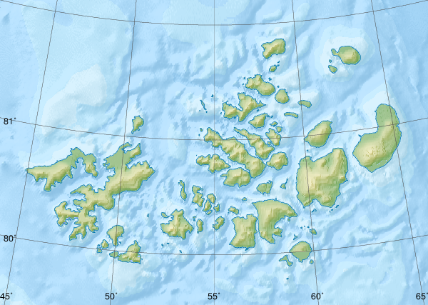
File:Relief Map of Franz Josef Land.png
外观
Relief_Map_of_Franz_Josef_Land.png (600 × 427像素,文件大小:403 KB,MIME类型:image/png)
文件历史
点击某个日期/时间查看对应时刻的文件。
| 日期/时间 | 缩略图 | 大小 | 用户 | 备注 | |
|---|---|---|---|---|---|
| 当前 | 2018年10月17日 (三) 09:41 |  | 600 × 427(403 KB) | RosssW | Полуостров стал островом https://ru.wikipedia.org/wiki/Остров_Юрия_Кучиева |
| 2012年5月15日 (二) 17:57 |  | 600 × 427(374 KB) | Nzeemin | bathymetry interpolated | |
| 2012年4月7日 (六) 08:50 |  | 600 × 427(251 KB) | Nzeemin | frame removed | |
| 2012年3月17日 (六) 19:14 |  | 600 × 427(251 KB) | Nzeemin | plus bathymetry | |
| 2012年3月10日 (六) 19:57 |  | 600 × 427(95 KB) | Nzeemin |
文件用途
以下页面使用本文件:
全域文件用途
以下其他wiki使用此文件:
- az.wikipedia.org上的用途
- be.wikipedia.org上的用途
- cs.wikipedia.org上的用途
- de.wikipedia.org上的用途
- Hayes-Insel
- Wilczek-Insel
- Wilczekland
- Rudolf-Insel
- Graham-Bell-Insel
- Hall-Insel (Franz-Josef-Land)
- Alexandraland
- Prinz-Georg-Land
- Koldewey-Insel
- Wiener-Neustadt-Insel
- Hohenlohe-Insel
- Northbrook-Insel
- Hooker-Insel
- Eva-Liv-Insel
- Jackson-Insel
- Champ-Insel
- Alger-Insel
- Vorlage:Positionskarte Franz-Josef-Land
- Ziegler-Insel
- Salisbury-Insel
- McClintock-Insel
- Perlmutt-Insel
- Arthur-Insel
- La-Ronciere-Insel
- Bell-Insel
- Mabel-Insel
- Becker-Insel
- Greely-Insel
- Salm-Insel
- Kane-Insel
- Kuhn-Insel (Franz-Josef-Land)
- Karl-Alexander-Insel
- Hoffmann-Insel
- Lütke-Insel
- Brosch-Insel
- Hochstetter-Inseln
- Luigi-Insel
- Bruce-Insel
查看此文件的更多全域用途。


