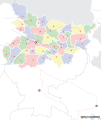
File:Bihar locator map.svg
外觀

此 SVG 檔案的 PNG 預覽的大小:505 × 599 像素。 其他解析度:202 × 240 像素 | 404 × 480 像素 | 647 × 768 像素 | 863 × 1,024 像素 | 1,726 × 2,048 像素 | 1,614 × 1,915 像素。
原始檔案 (SVG 檔案,表面大小:1,614 × 1,915 像素,檔案大小:258 KB)
檔案歷史
點選日期/時間以檢視該時間的檔案版本。
| 日期/時間 | 縮圖 | 尺寸 | 使用者 | 備註 | |
|---|---|---|---|---|---|
| 目前 | 2008年9月7日 (日) 06:45 |  | 1,614 × 1,915(258 KB) | Planemad | |
| 2008年9月6日 (六) 20:15 |  | 1,614 × 1,915(201 KB) | Planemad | ||
| 2008年4月15日 (二) 17:29 |  | 658 × 491(163 KB) | Mkeranat~commonswiki | Updated the map | |
| 2008年4月15日 (二) 16:47 |  | 658 × 491(163 KB) | Mkeranat~commonswiki | {{Information |Title=Bihar locator map |Description=Locator map for the state of w:Bihar |Source=self-made based on India map by w:User:PlaneMad |Date=April 2008 |Author= Mkeranat |Permission= |other_versions= }} |
檔案用途
下列頁面有用到此檔案:
全域檔案使用狀況
以下其他 wiki 使用了這個檔案:
- ar.wikipedia.org 的使用狀況
- as.wikipedia.org 的使用狀況
- awa.wikipedia.org 的使用狀況
- bn.wikipedia.org 的使用狀況
- বিহার
- পাটনা
- অমরপুর
- কলগং
- দ্বারভাঙা
- গয়া
- ইসলামপুর (বিহার)
- জমুই
- জেহানাবাদ
- কসবা, বিহার
- কাটাইয়া
- কাটিহার
- আরারিয়া
- খগড়িয়া
- আরেরাজ
- কিশানগঞ্জ
- আরা, বিহার
- আসরগঞ্জ
- মাধেপুরা
- মধুবনী
- ঔরঙ্গাবাদ, বিহার
- মোতিহারী
- মুঙ্গের
- মজঃফরপুর
- নওয়াদা
- পূর্ণিয়া
- সহর্সা
- সমস্তিপুর
- শেখপুরা
- শিউহর
- সীতামঢ়ী
- সুপৌল
- বাঁকা
- ওয়ারিসালিগঞ্জ
- বেগুসারাই
- বেতিয়া
- ভাগলপুর
- বীরপুর
- বুদ্ধ গয়া
- চাকিয়া
- ছাপরা
- নালন্দা
- বিক্রমশিলা বিশ্ববিদ্যালয়
- টেমপ্লেট:অবস্থান মানচিত্র ভারত বিহার
- পাবাপুরী
- পাটলীপুত্র
- বৈশালী (প্রাচীন শহর)
檢視此檔案的更多全域使用狀況。

