
File:Extratropical formation areas.jpg
預覽大小:800 × 400 像素。 其他解析度:320 × 160 像素 | 640 × 320 像素 | 1,024 × 512 像素 | 1,999 × 1,000 像素。
原始檔案 (1,999 × 1,000 像素,檔案大小:525 KB,MIME 類型:image/jpeg)
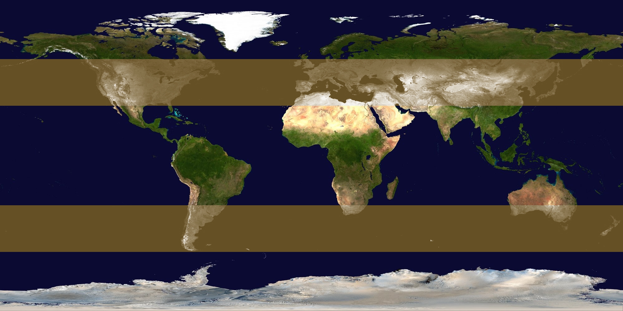
| 描述 | Image identifying extratropical cyclone formation areas, between approximately 30° and 60° N/S latitude. | ||
| 日期 | |||
| 來源 | background: Image:Whole world - land and oceans 12000.jpg, edit by me | ||
| 作者 | Titoxd | ||
| 授權許可 (重用此檔案) |
|
檔案歷史
點選日期/時間以檢視該時間的檔案版本。
| 日期/時間 | 縮圖 | 尺寸 | 使用者 | 備註 | |
|---|---|---|---|---|---|
| 目前 | 2006年10月23日 (一) 17:25 | | 1,999 × 1,000(525 KB) | Titoxd | {{information | description = Image identifying w:extratropical cyclone formation areas, between approximately 30° and 60° N/S w:latitude. | source = background: Image:Whole world - land and oceans 12000.jpg, edit by me | date = 2006-10 |
檔案用途
下列頁面有用到此檔案:
全域檔案使用狀況
以下其他 wiki 使用了這個檔案:
- ast.wikipedia.org 的使用狀況
- cv.wikipedia.org 的使用狀況
- en.wikipedia.org 的使用狀況
- es.wikipedia.org 的使用狀況
- fa.wikipedia.org 的使用狀況
- fr.wikipedia.org 的使用狀況
- hy.wikipedia.org 的使用狀況
- kk.wikipedia.org 的使用狀況
- ko.wikipedia.org 的使用狀況
- ko.wiktionary.org 的使用狀況
- nn.wikipedia.org 的使用狀況
- no.wikipedia.org 的使用狀況
- pt.wikipedia.org 的使用狀況
- ru.wikipedia.org 的使用狀況
- ta.wikipedia.org 的使用狀況
- tr.wikipedia.org 的使用狀況
- xmf.wikipedia.org 的使用狀況