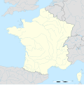
File:France blank.svg
外觀

此 SVG 檔案的 PNG 預覽的大小:599 × 599 像素。 其他解析度:240 × 240 像素 | 480 × 480 像素 | 768 × 768 像素 | 1,023 × 1,024 像素 | 2,047 × 2,048 像素 | 1,796 × 1,797 像素。
原始檔案 (SVG 檔案,表面大小:1,796 × 1,797 像素,檔案大小:240 KB)
檔案歷史
點選日期/時間以檢視該時間的檔案版本。
| 日期/時間 | 縮圖 | 尺寸 | 使用者 | 備註 | |
|---|---|---|---|---|---|
| 目前 | 2017年10月19日 (四) 13:37 |  | 1,796 × 1,797(240 KB) | Sting | No borders over the Lake of Constance |
| 2012年10月2日 (二) 11:38 |  | 1,796 × 1,797(232 KB) | Palosirkka | Scrubbed with http://codedread.com/scour/ | |
| 2008年11月7日 (五) 13:50 |  | 1,796 × 1,797(559 KB) | Sting | + boundary for the Channel Islands ; - canals | |
| 2008年9月25日 (四) 02:46 |  | 1,796 × 1,797(564 KB) | Sting | Completely new version using NGDC WDBII data and with known projection | |
| 2006年9月21日 (四) 16:34 |  | 1,796 × 1,796(973 KB) | Sting | Colours | |
| 2006年9月20日 (三) 00:34 |  | 1,796 × 1,796(974 KB) | Sting | {{Information |Description=SVG map of France |Source=Own work |Date=September 2006 |Author=Eric Gaba (Sting) |Permission=CC-BY-SA-2.5 |other_versions= }} ---- {{fr}} * '''Sujet :''' Carte vectorielle de la France ; * '''Auteur :''' Eric |
檔案用途
沒有使用此檔案的頁面。
全域檔案使用狀況
以下其他 wiki 使用了這個檔案:
- ar.wikipedia.org 的使用狀況
- en.wikipedia.org 的使用狀況
- fr.wikipedia.org 的使用狀況
- Utilisateur:Yug/Archive2016
- Discussion modèle:Fragéoloc
- Discussion Portail:France/2005-2007
- Wikipédia:Atelier graphique/Images à améliorer/Archives/Septembre 2007
- Utilisateur:Wikisoft*/Cartes
- Utilisateur:Wikisoft*/Tests cartes 1
- Utilisateur:Wikisoft*/Modèle:Infobox Montagnes de France
- Discussion utilisateur:Wikisoft*/Modèle:Infobox Montagnes de France
- Wikipédia:Atelier graphique/Cartes/Archives/octobre 2008
- Utilisateur:Géobox/5
- Wikipédia:Atelier graphique/Cartes/Archives/juillet 2009
- Discussion utilisateur:Sting/Archive 08
- Wikipédia:Atelier graphique/Cartes/Archives/janvier 2010
- Utilisateur:Géobox/Géolocalisation/France
- Utilisateur:Wikisoft*/France
- Wikipédia:Atelier graphique/Cartes/Archives/Demandes mises en sommeil/France
- Utilisateur:Wikisoft*/Modèle:Géobox Montagnes
- Wikipédia:Opération Libre
- gan.wikipedia.org 的使用狀況
- it.wikibooks.org 的使用狀況
- lb.wikipedia.org 的使用狀況


