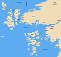
File:Gbg karta.jpg
外觀

預覽大小:637 × 599 像素。 其他解析度:255 × 240 像素 | 510 × 480 像素 | 816 × 768 像素 | 1,089 × 1,024 像素 | 1,417 × 1,333 像素。
原始檔案 (1,417 × 1,333 像素,檔案大小:342 KB,MIME 類型:image/jpeg)
檔案歷史
點選日期/時間以檢視該時間的檔案版本。
| 日期/時間 | 縮圖 | 尺寸 | 使用者 | 備註 | |
|---|---|---|---|---|---|
| 目前 | 2014年6月21日 (六) 12:51 |  | 1,417 × 1,333(342 KB) | Paracel63 | Corrected Skagerrak to Kattegatt (line between them stands by the Pater Noster lighthouse) |
| 2014年6月21日 (六) 12:41 |  | 1,417 × 1,333(335 KB) | Paracel63 | corrected to Stora _Förö_ and _Styrsö_. | |
| 2006年6月19日 (一) 21:52 |  | 1,417 × 1,333(142 KB) | Apw | {{Information |Description=The Gothenburg skerries |Source=http://sv.wikipedia.org/wiki/Göteborgs skärgård |Date=2006-02-17 |Author=AHA |Permission=GNU |other_versions=? }} |
檔案用途
下列頁面有用到此檔案:
全域檔案使用狀況
以下其他 wiki 使用了這個檔案:
- da.wikipedia.org 的使用狀況
- de.wikipedia.org 的使用狀況
- en.wikipedia.org 的使用狀況
- en.wikivoyage.org 的使用狀況
- es.wikipedia.org 的使用狀況
- fi.wikipedia.org 的使用狀況
- fr.wikipedia.org 的使用狀況
- he.wikivoyage.org 的使用狀況
- mk.wikipedia.org 的使用狀況
- pl.wikipedia.org 的使用狀況
- uk.wikivoyage.org 的使用狀況
- www.wikidata.org 的使用狀況


