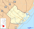
File:Location map of Atlantic County, New Jersey.svg
外觀

此 SVG 檔案的 PNG 預覽的大小:700 × 600 像素。 其他解析度:280 × 240 像素 | 560 × 480 像素 | 896 × 768 像素 | 1,195 × 1,024 像素 | 2,389 × 2,048 像素。
原始檔案 (SVG 檔案,表面大小:896 × 768 像素,檔案大小:1.22 MB)
檔案歷史
點選日期/時間以檢視該時間的檔案版本。
| 日期/時間 | 縮圖 | 尺寸 | 使用者 | 備註 | |
|---|---|---|---|---|---|
| 目前 | 2012年9月20日 (四) 16:54 |  | 896 × 768(1.22 MB) | Omnedon | == {{int:filedesc}} == {{Information |Description={{en|This is a map of Atlantic County, New Jersey, USA which includes incorporated settlements, township borders, and major highways.}} |Source=My own work, using cust... |
檔案用途
下列3個頁面有用到此檔案:
全域檔案使用狀況
以下其他 wiki 使用了這個檔案:
- ar.wikipedia.org 的使用狀況
- azb.wikipedia.org 的使用狀況
- ceb.wikipedia.org 的使用狀況
- en.wikipedia.org 的使用狀況
- Atlantic City, New Jersey
- Absecon, New Jersey
- Brigantine, New Jersey
- Buena, New Jersey
- Buena Vista Township, New Jersey
- Collings Lakes, New Jersey
- Corbin City, New Jersey
- Egg Harbor Township, New Jersey
- Egg Harbor City, New Jersey
- Estell Manor, New Jersey
- Folsom, New Jersey
- Galloway Township, New Jersey
- Hamilton Township, Atlantic County, New Jersey
- Hammonton, New Jersey
- Linwood, New Jersey
- Longport, New Jersey
- Margate City, New Jersey
- Mays Landing, New Jersey
- Mullica Township, New Jersey
- Ventnor City, New Jersey
- Weymouth Township, New Jersey
- Northfield, New Jersey
- Pleasantville, New Jersey
- Pomona, New Jersey
- Port Republic, New Jersey
- Somers Point, New Jersey
- Stockton University
- Boardwalk Hall
- Landing Creek (New Jersey)
- Sweetwater, New Jersey
- Marven Gardens
- Smithville, Atlantic County, New Jersey
- Richland, New Jersey
- Landisville, New Jersey
- Dorothy, New Jersey
- Elwood, New Jersey
- Port Republic Historic District (Port Republic, New Jersey)
檢視此檔案的更多全域使用狀況。

