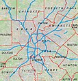
File:Metro atlanta.jpg
外觀

預覽大小:570 × 599 像素。 其他解析度:228 × 240 像素 | 456 × 480 像素 | 730 × 768 像素 | 1,025 × 1,078 像素。
原始檔案 (1,025 × 1,078 像素,檔案大小:385 KB,MIME 類型:image/jpeg)
檔案歷史
點選日期/時間以檢視該時間的檔案版本。
| 日期/時間 | 縮圖 | 尺寸 | 使用者 | 備註 | |
|---|---|---|---|---|---|
| 目前 | 2011年4月18日 (一) 00:44 |  | 1,025 × 1,078(385 KB) | Keizers | +county borders and airport |
| 2011年4月15日 (五) 17:22 |  | 1,025 × 1,078(571 KB) | Keizers | shows all counties now | |
| 2011年4月14日 (四) 17:38 |  | 1,025 × 1,078(548 KB) | Keizers | added thicker freeway lines and 3 key county names | |
| 2011年4月14日 (四) 15:16 |  | 1,025 × 1,078(362 KB) | Keizers | {{Information |Description ={{en|1=Metro Atlanta from Open Street Map}} |Source =Open street map |Author =Open street map |Date =2011-04-12 |Permission = |other_versions = }} Category:Atlanta maps |
檔案用途
下列3個頁面有用到此檔案:
全域檔案使用狀況
以下其他 wiki 使用了這個檔案:
- ar.wikipedia.org 的使用狀況
- ban.wikipedia.org 的使用狀況
- bcl.wikipedia.org 的使用狀況
- bn.wikipedia.org 的使用狀況
- ceb.wikipedia.org 的使用狀況
- de.wikipedia.org 的使用狀況
- en.wikipedia.org 的使用狀況
- Cobb County, Georgia
- Holly Springs, Georgia
- College Park, Georgia
- Jonesboro, Georgia
- Austell, Georgia
- Mableton, Georgia
- Vinings, Georgia
- Newnan, Georgia
- Avondale Estates, Georgia
- Belvedere Park, Georgia
- Candler-McAfee, Georgia
- Doraville, Georgia
- Lithonia, Georgia
- Panthersville, Georgia
- Scottdale, Georgia
- Stone Mountain, Georgia
- Cumming, Georgia
- Fairburn, Georgia
- Buford, Georgia
- Loganville, Georgia
- Rest Haven, Georgia
- Stockbridge, Georgia
- Covington, Georgia
- Dallas, Georgia
- Hiram, Georgia
- Oglethorpe University
- Big Chicken
- Kennesaw Mountain National Battlefield Park
- State Farm Arena
- Buckhead
- Etowah Indian Mounds
- Panola Mountain
- SciTrek
- Noonday, Georgia
- Delta Flight Museum
- Bradley Observatory
- Downtown Atlanta
- Ben Hill, Atlanta
- Marietta National Cemetery
- Chattahoochee Hills, Georgia
- Hickory Flat, Georgia
檢視此檔案的更多全域使用狀況。


