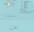
十度海峽
外觀
| Ten Degree Channel | |
|---|---|
在安達曼-尼科巴群島的位置 | |
| 座標 | 10°00′00″N 92°28′58″E / 10°N 92.4828°E |
| 類型 | 水道 |
| 屬於 | 印度洋 |
十度海峽(Ten Degree Channel)位於孟加拉灣安達曼-尼科巴群島間的海峽,小安達曼島與卡爾尼科巴島隔海峽相望。十度海峽寬約150公里,東西走向。因位於北緯十度而得名。[1][2]
-
Ten Degree Channel is in the red square
-
Andaman and Nicobar Islands map
-
Ten Degrees Channel, closeup
參考資料
[編輯]- ^ Chinese naval ships detected near Andamans. The Times of India. [2022-01-18]. (原始內容存檔於2015-09-11).
- ^ Ten degrees channel (India) (頁面存檔備份,存於互聯網檔案館), Sea-Seek]
| 這是一篇有關印度地理的小作品。您可以透過編輯或修訂擴充其內容。 |


