庫姆蘭
外觀
| 庫姆蘭 | |
|---|---|
| קומראן خربة قمران | |
 | |
| 位置 | 西岸Kalya |
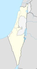
| 座標 | 31°44′27″N 35°27′31″E / 31.74083°N 35.45861°E |
| 時期 | 希臘化時代到羅馬帝國 |
| 建成時間 | BC134-104 |
| 廢棄時間 | 68 |
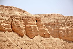
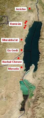
庫姆蘭(希伯來語:קומראן; 阿拉伯語:خربة قمران Khirbet Qumran、(Khirbet Qumran,或譯昆蘭或坎巒、谷木蘭)) 是西岸的一個考古遺址,由以色列的庫姆蘭國家公園管理。[1] 它位於死海西北岸一英里乾燥的高原,靠近以色列定居點和基布茲Kalya。希臘化時代居民點建於John Hyrcanus在位時期(公元前134-104年)或稍後,直到公元68年或稍後被羅馬人摧毀。這是最接近埋藏死海古卷的庫姆蘭洞穴的居民點。在庫姆蘭的主要發掘是由羅蘭德·沃克斯在20世紀50年代進行。

參考
[編輯]- ^ Qumran National Park. Israel Nature and Parks Authority. [2014年5月30日]. (原始內容存檔於2014年5月31日).
- Bar-Adon, Pessah, "The Hasmonean Fortresses and the Status of Khirbet Qumran", Eretz Israel 15 (1981): 349-52.
- Bar-Nathan, Rachel, "Qumran and the Hasmonaean and Herodian Winter Palaces of Jericho", in The Site of the Dead Sea Scrolls: Archaeological Interpretations and Debates, (Studies on the Texts of the Desert of Judah, Vol. 57), ed. by Katharina Galor, Jean-Baptiste Humbert, and Jurgen Zangenberg, (Leiden: Brill, 2006), 263-277.
- Boccaccini, Gabriele, Beyond the Essene Hypothesis: The Parting of Ways between Qumran and Enochic Judaism (Grand Rapids: Eerdmans, 1998).

